Apollo 17 Flown Lunar Orbit Chart Framed
Apollo 17 mission flown and used photography map from the collection of Commander Gene Cernan
Price: $5,295
Click here to buy this item
click for large version
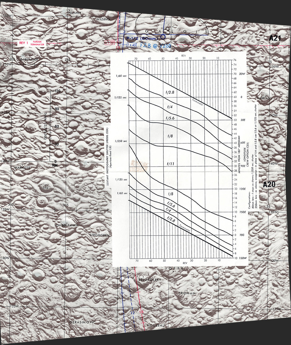
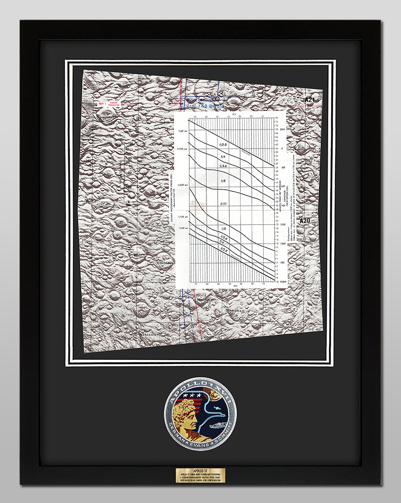
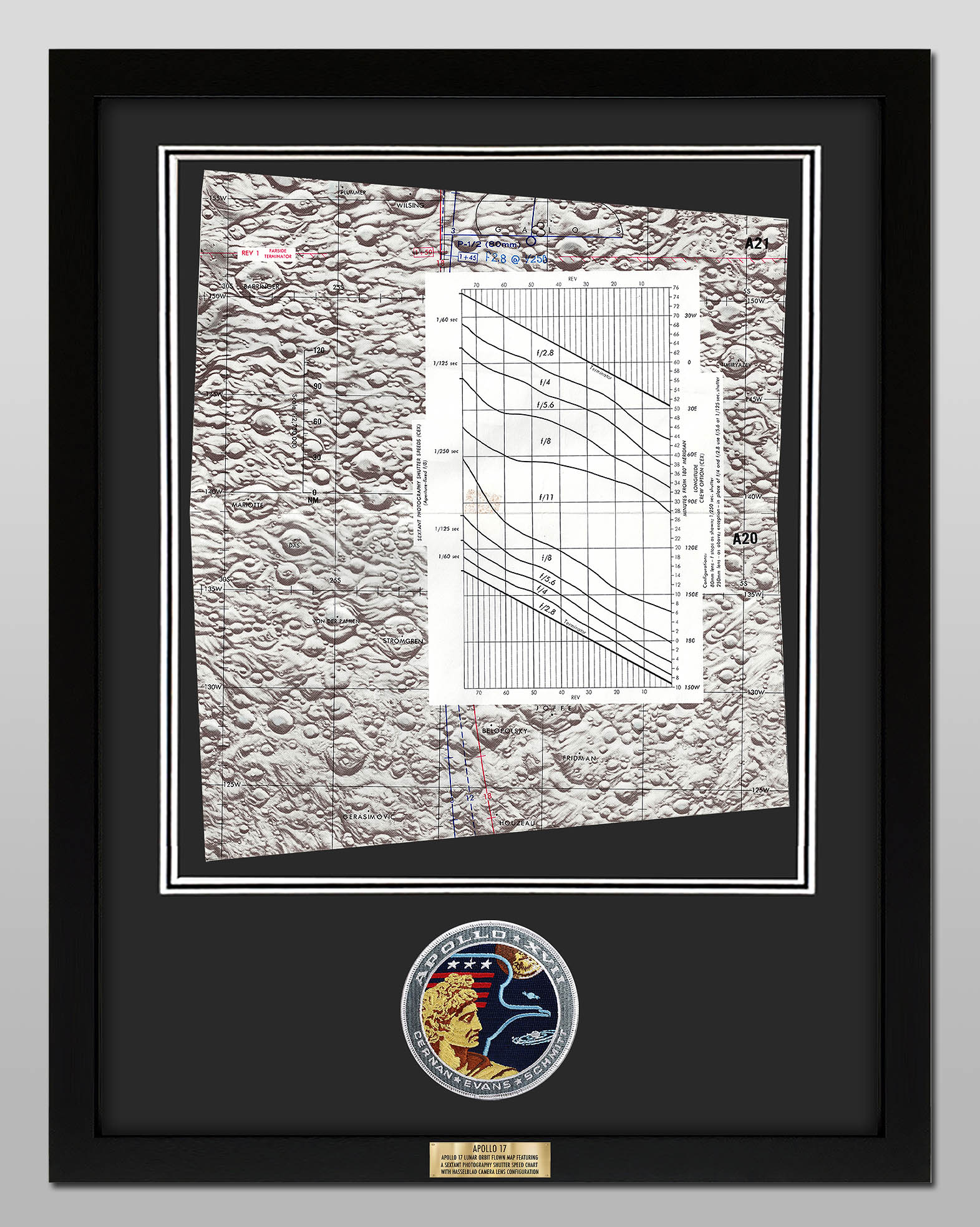
This double Apollo 17 flown photography map measuring approx 13 inch x 15.5 inch came from the collection of Mission Commander Gene Cernan. This map was flown to the moon aboard Command Module America during Apollo 17 in December 1972 and was used by the crew to guide their efforts in photographing areas of the lunar surface for scientific study. The double map features the sextant photography shutter speed chart, detailing the Hasselblad camera lens configuration.
The map, which is marked with symbols that include the orbital path and various lunar surface features, shows the path that the crew would cross over during orbital revolutions 1 through 18 for both the front side and the back side of the moon. Background coloration indicates variance in the reflectance of lunar areas under full illumination.
Product Information:
Double map chart flown to the moon aboard Apollo 17
Measures approx 13 inch x 15.5 inch
Framed using UV100 gallery plexiglass anti-reflective acrylic glazing
Framed using acid-free double-mounted matting
Frame measures approx 19" x 25"
Includes a copy of the Apollo 17 stowage list with the chart highlighted
Includes certificate of authenticity with holographic logo and Space Collective stamp
Authentication Information:
This Apollo 17 flown map came from the collection of Mission Commander Gene Cernan. One section (A1) of the chart was hand-signed and flight-certified in blue felt tip, "Flown on Apollo XVII / Gene Cernan." The chart was identified in the legend box and bore the serial numbers "SKB 32100123-377, S/N 1001," which correspond with those found in the Apollo 17 stowage list, which will also be included with each map plate.
Ships from USA


Click here to buy this item
If you have any questions email us
To be notified of future items like this one Join Our Mailing List
Contact Us
All design and images © moonpans.com
Click here to buy this item
click for large version
This double Apollo 17 flown photography map measuring approx 13 inch x 15.5 inch came from the collection of Mission Commander Gene Cernan. This map was flown to the moon aboard Command Module America during Apollo 17 in December 1972 and was used by the crew to guide their efforts in photographing areas of the lunar surface for scientific study. The double map features the sextant photography shutter speed chart, detailing the Hasselblad camera lens configuration.
The map, which is marked with symbols that include the orbital path and various lunar surface features, shows the path that the crew would cross over during orbital revolutions 1 through 18 for both the front side and the back side of the moon. Background coloration indicates variance in the reflectance of lunar areas under full illumination.
Product Information:
Double map chart flown to the moon aboard Apollo 17
Measures approx 13 inch x 15.5 inch
Framed using UV100 gallery plexiglass anti-reflective acrylic glazing
Framed using acid-free double-mounted matting
Frame measures approx 19" x 25"
Includes a copy of the Apollo 17 stowage list with the chart highlighted
Includes certificate of authenticity with holographic logo and Space Collective stamp
Authentication Information:
This Apollo 17 flown map came from the collection of Mission Commander Gene Cernan. One section (A1) of the chart was hand-signed and flight-certified in blue felt tip, "Flown on Apollo XVII / Gene Cernan." The chart was identified in the legend box and bore the serial numbers "SKB 32100123-377, S/N 1001," which correspond with those found in the Apollo 17 stowage list, which will also be included with each map plate.
The map, which is marked with symbols that include the orbital path and various lunar surface features, shows the path that the crew would cross over during orbital revolutions 1 through 18 for both the front side and the back side of the moon. Background coloration indicates variance in the reflectance of lunar areas under full illumination.
Product Information:
Double map chart flown to the moon aboard Apollo 17
Measures approx 13 inch x 15.5 inch
Framed using UV100 gallery plexiglass anti-reflective acrylic glazing
Framed using acid-free double-mounted matting
Frame measures approx 19" x 25"
Includes a copy of the Apollo 17 stowage list with the chart highlighted
Includes certificate of authenticity with holographic logo and Space Collective stamp
Authentication Information:
This Apollo 17 flown map came from the collection of Mission Commander Gene Cernan. One section (A1) of the chart was hand-signed and flight-certified in blue felt tip, "Flown on Apollo XVII / Gene Cernan." The chart was identified in the legend box and bore the serial numbers "SKB 32100123-377, S/N 1001," which correspond with those found in the Apollo 17 stowage list, which will also be included with each map plate.
Ships from USA